In 1849, incoming Europeans received nature’s message that, in Western Australia, they were in earthquake country.
As recorded: “On Saturday last, about a quarter past four o’clock am, several inhabitants of Perth were awoke by what they conceived to be a slight shock of an earthquake.”
Then, in November 1906 off Carnarvon, the largest-known Australian earthquake – over seven on the Richter scale – was felt as far away as Albany. Far out to sea, it caused no damage.
The largest quake affecting Western Australia in the modern era was centred offshore in 2019. It rumbled-in from 202 kms west of Broome, shaking the ground underfoot of holidaymakers on popular Cable Beach. With a magnitude of 6.6, it rattled stores off supermarket shelves and caused minor damage throughout the town. It delayed the start of the Broome Cup, to the consternation of race officials and thousands of punters in town for the year’s premium social event.
Worse was to follow over the generations as urban populations spread into the Goldfields, Murchison and Wheatbelt.
Wheatbelt town Meckering was ripped apart by the State’s strongest earthquake on land. Just before 11am on October 14, 1968, a severe earthquake struck.
In just 40 seconds it ripped-up earth and destroyed almost the whole town, population 600. Seventeen people were injured with no loss of life. The earth rose more than two metres along a 37km-long fault line.
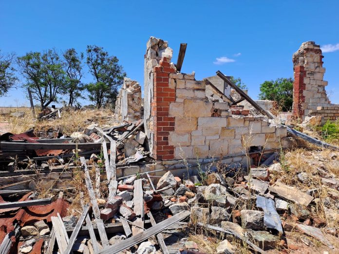
Rubble of a 1904 stonewall homestead owned by Graham and Alice Snooke can be seen today. Mrs Snooke thanked her lucky stars recovering two-year-old daughter Debbie from her cot. The bedroom stone wall fell out and not inwards.
As Mrs Snooke told Have a Go News: “I was holding her in my arms. The birds started to sing and Debbie just said: “Birdie, birdie, birdie.”
Buildings in nearby towns were damaged or cracked as were the Great Eastern Highway, the Eastern Goldfields Railway and the Goldfields water pipeline.
At 6.9 on the Richter Scale, it was Australia’s most severe quake to that time and still ranks as the nation’s third. It passed the previous record-holder, a 6.3 quake at Meeberrie in the Murchison on April 29, 1941 that ruptured the earth, damaged buildings and burst water tanks.
Between 1900 and 1968, State government files recorded six severe earthquakes at various locations.
A severe rumble at Cadoux in the Wheatbelt on 2 June, 1979 is listed as Australia’s 10th-worst. The quake injured one person and severely damaged 25 buildings, rail lines, pipes and powerlines, costing $3.8 million to repair. A 15km-long fault opened along the ground which has been recorded only 12 times in Australian history.
The most violent earthquake regions listed in Australia are parts of WA, Flinders Ranges in SA, and an area from Tasmania to northern NSW.
The nation’s worst quake toll occurred in Newcastle, NSW, on December 28, 1989, when 13 people died, 160 others were hospitalised and $4 billion damage was caused to 35,000 homes, 147 schools and 3,000 buildings. It was felt 800kms away.
The Indo-Australian plate that our continent sits on continues to collide with the Pacific Plate and we will keep having earthquakes.
So far, Western Australia has paid a low price.
Mrs Snooke has compiled a book, Forty Seconds, with locals’ memories of the day and historic pictures. Details: Email gwaesnooke@icloud.com
Relics and photos can be seen in Meckering’s memorial park.


